|
|
:
Ani's Place |
|
|
||||||
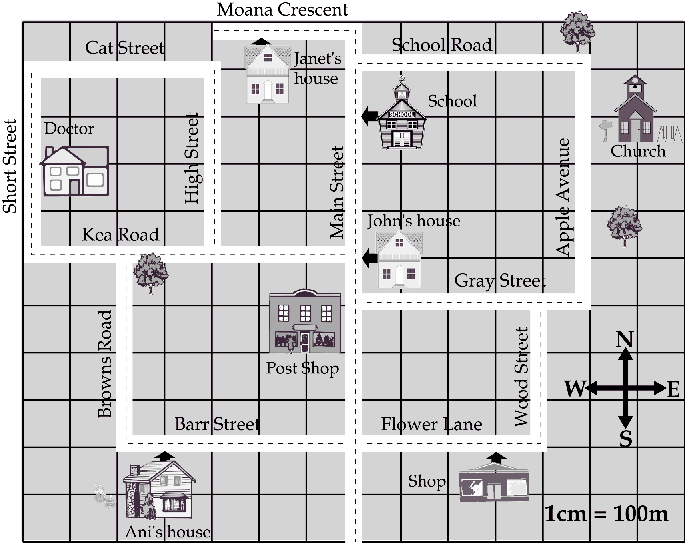
| Focus: Interpreting a town map, using a scale. | ||||||
|
||||||
|
Questions / instructions: |
||||||
|
%
responses
|
||||||
 |
y4
|
|||||
| 1. How far does John walk to school? |
300
m
|
11
|
||||
| 2. What direction does he walk? |
north
|
52
|
||||
| 3. How far does Ani walk from her house to the shop? |
700
m
|
9
|
||||
| 4. What direction does she walk? |
east
|
50
|
||||
| 5.
Ani wants to drive to her friend Janet's house. Draw the shortest way on the map. Use the red pencil. |
Barr
St (east) > Main St (north) > Moana Cres (west)
|
55
|
||||
| Commentary: About half of the year 4 children were able to identify directions and routes, but only about 10 percent could use the scale. |
||||||
|
|
||
|
|
||