|
||||||||||
|
|||||||||||||
| Questions/instructions:
|
|||||||||||||
| %
responses 2003 ('99) |
|||||||||||||
| y4
|
y8 |
||||||||||||
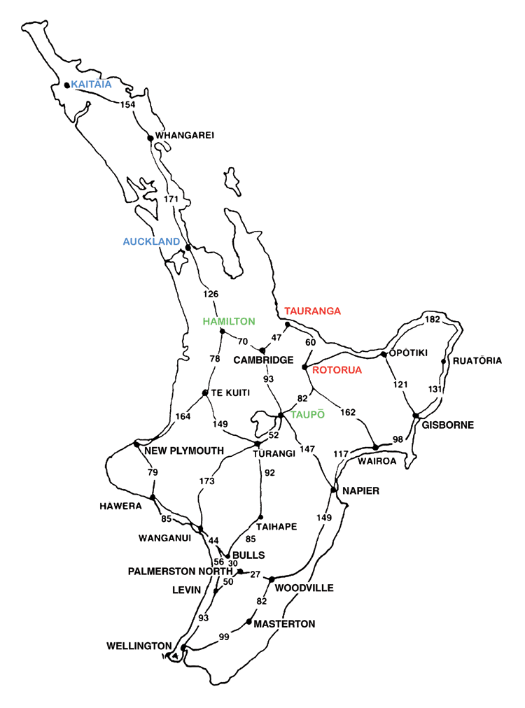
| 1. How far is it from Rotorua to Tauranga? | 60km
|
77
(83) |
94
(94) |
||||||||||
| 2. How would I work out how far it is from Auckland to Kaitaia? | 325km
|
35
(40) |
75
(60) |
||||||||||
| 3. If I wanted to go the shortest way from Taupo to Hamilton which town would I go through? | Cambridge
|
91
(90) |
92
(98) |
||||||||||
|
Total
score: |
4
|
32
(34) |
67
(58) |
||||||||||
3
|
8
(11) |
20
(23) |
|||||||||||
2
|
35
(37) |
10
(16) |
|||||||||||
1
|
22
(16) |
3
(3) |
|||||||||||
0
|
3
(2) |
0
(0) |
|||||||||||
| Commentary: There was relatively little change between 1999 and 2003 in the ability of year 4 and year 8 students to determine distances and routes on a map. About twice as many year 8 students as year 4 students got all questions correct in 2003 (67 percent versus 32 percent). |
|||||||||||||