|
||||||||||
|
||||||||||||
|
||||||||||||
| |
%
responses 2005 ('01) |
|||||||||||
| Y4 |
Y8 |
|||||||||||
| 1.
Why might people find this book useful? |
good
for finding out where places are |
92 |
||||||||||
| Have
a few minutes to look through this atlas, then I’ll ask you to find
some things. Allow time. The index in a book tells us where information can be found. |
||||||||||||
| 2.
Where would you find the World Index in this atlas? Tell me how you found
it. |
||||||||||||
| Record
if student found the World Index or not. If the student can’t find the index, show them. |
found
World Index |
92 |
||||||||||
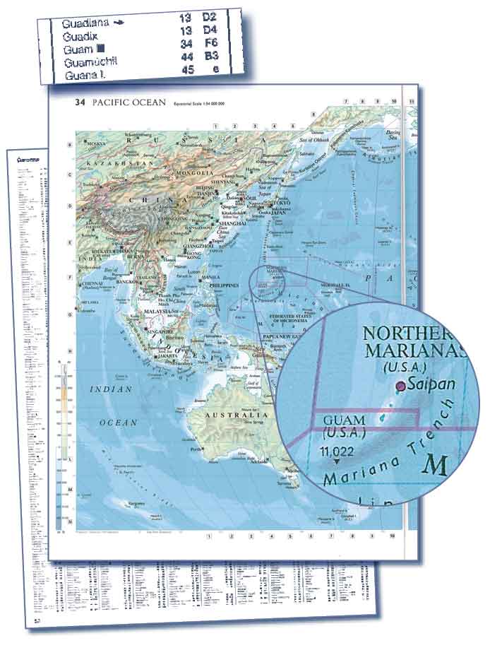
| Hand student card – Guam. [click on images to enlarge.] 3. How would you find a map of Guam in this atlas? Show me where it is and tell me how you found this map. Record if student found Guam or not. |
 |
|||||||||||
located
map of Guam |
83 |
|||||||||||
used
index to find map |
91 |
|||||||||||
used
co-odinates to find Guam on map |
82 |
|||||||||||
| Hand
student card – Doughboy Bay. Show student where the New Zealand Index is found in the atlas (p15). [click on images to enlarge.] 4. Using the New Zealand Index look up Doughboy Bay. What map number and position does it give? Record map number and position given. |
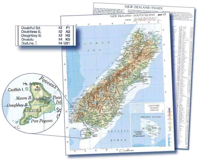 |
|||||||||||
map
number found |
98 |
|||||||||||
co-ordinates
given correctly |
97 |
|||||||||||
| 5.
Using the map number and position try to find Doughboy Bay in this atlas.
When you have found it show me. |
||||||||||||
| Record if the student found Doughboy Bay or not. | found
Doughboy Bay on the map |
88 |
||||||||||
| Let’s
look at two maps about New Zealand. Hand student the two maps of New Zealand. [same as for Year 4 version on adjacent page] |
||||||||||||
| 6.
What is different about the information on these two maps? Record student’s answer. |
||||||||||||
mentioned
one map is taken from the satellite |
36 |
|||||||||||
mentioned
map uses colour to show height of mountains, rivers, lakes |
30 |
|||||||||||
mentioned
one map has names of places on it |
86 |
|||||||||||
mentioned
one map has clouds and weather systems on it |
66 |
|||||||||||
mentioned
anything else relevant to maps |
29 |
|||||||||||
Total
score: |
11–12 |
15 |
||||||||||
9–10
|
51 |
|||||||||||
7–8
|
23 |
|||||||||||
5–6
|
6 |
|||||||||||
3–4
|
4 |
|||||||||||
0–2
|
1 |
|||||||||||
Commentary:
|
||||||||||||