Approach: One
to one |
 |
732k |
Resources: List
of place names; pencil; marker pen. |
Questions / instructions:
I would like you to draw me a quick
sketch map of New Zealand. Don't worry too much about your drawing, I would just
like a quick outline of the map which shows the shape of New Zealand's 3 main
islands.
Give student a pencil. Allow student time to draw map. |
|
%
responses |
y4 |
y8 |
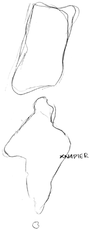
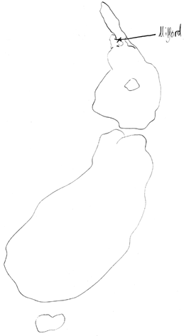
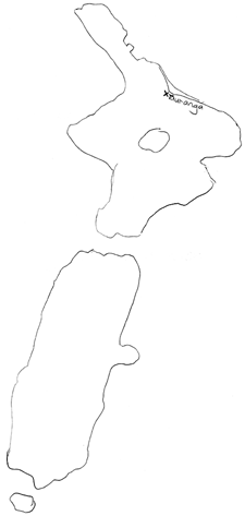
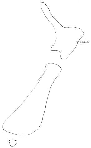
1. On your map, put a cross to show
the town or city where you live or the one which is closest to where you live.
Write down the name of the town or city beside the cross.
Check and if necessary help the student with the spelling of the place name.
|
Map
of NZ drawn:
3
main islands
2 main islands
other |
50
25
25 |
87
10
3 |
Proportions:
about
right
North Island too large
South Island too large
not applicable |
38
19
14
29 |
66
19
10
5 |
Shape
and relative positions of islands:
approximately correct
good attempt but problems
little resemblence
not applicable |
13
40
31
16 |
38
48
12
2 |
Placement
of home town or city on map:
general
area in correct island
correct island, but wildly misplaced
inappropriate
not applicable |
51
10
21
18 |
85
9
4
2 |
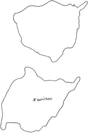
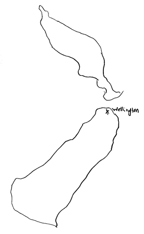
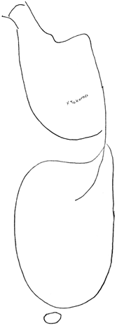
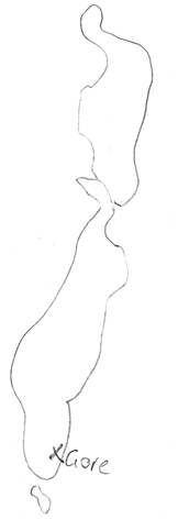
student
drawings of New Zealand |
Turn the page to show the map
of the world.
2. Here is a map of the world. Draw
a ring around New Zealand. |
Circled
New Zealand |
88 |
97 |
Show the student the list of places,
and give them the marker pen.
3. Now I want you to write the numbers on the map to show where the places that
are written on this list. I'll read you the numbers and place names, and you write
the numbers where you think they should go on the map.
|
Continents
and countries accurately placed:
1. Australia
2. North America
3. South America
4. India [not year 4]
5. China [not year 4]
6. Africa
7. British Isles [not year 4]
8. Europe
9. Pacific Ocean
10. Atlantic Ocean [not year 4] |
75
34
29
-
-
32
-
28
61
- |
98
71
63
25
36
62
30
70
84
29 |
Commentary:
The first part of this task looked at students' abilities to represent the general
configuration of the map of New Zealand by drawing a sketch map unaided, followed
by marking their own home town or city on their map. The large majority of year
8 students scored well whereas about half of year 4 students showed comparable
skill. The second part of the task investigated student knowledge of locations
of selected continents, oceans and countries on a world map. Large numbers of
students at both levels had difficulty identifying many of the places listed. |
|
[ top
of the page | Social Studies
Report 1997 ] |
|