|
||||||||||
|
|||||||||||||
| Questions/instructions:
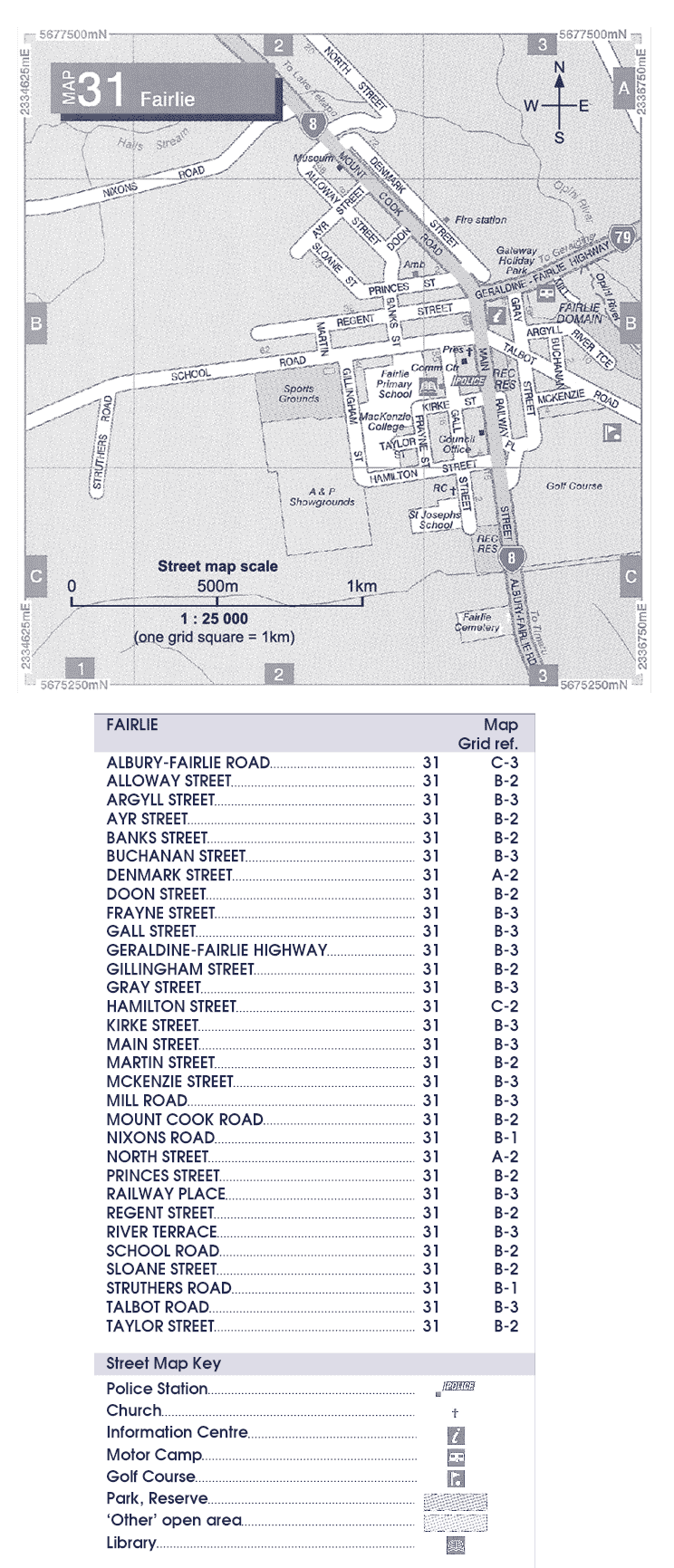
Here is a map of Fairlie. If you drive into Fairlie from Timaru, you come in on Main Street. |
|||||||||||||
%
responses |
|||||||||||||
| y8
|
|||||||||||||
| [click
on map or key to enlarge]
|
1. If you turned from Main Street into School Road what direction would you be going
|
||||||||||||
d |
87 |
||||||||||||
| 2. Look at the key. On the map put a circle around the motor camp. | |||||||||||||
circled
motor camp correctly |
79 |
||||||||||||
3. What street is the information centre in?
|
|||||||||||||
b
|
91 |
||||||||||||
| 4. What is the grid reference for the sports ground? | |||||||||||||
B–2
|
62 |
||||||||||||
2–B
|
7 |
||||||||||||
5. Where is the police station?
|
|||||||||||||
b
|
91 |
||||||||||||
| 6.
Look at the scale on the map. How long is Hamilton Street? |
|||||||||||||
| 400–500m
|
58 |
||||||||||||
|
Total
score: |
7 |
33 |
|||||||||||
6
|
23 |
||||||||||||
4–5
|
30 |
||||||||||||
2–3
|
11 |
||||||||||||
0–1
|
3 |
||||||||||||
| Commentary: Just over 50 percent of year 8 students obtained a total score of six or seven. Interpreting straightforward information from a map was achieved by about 80 to 90 percent of students. Using the scale of the map to interpret distance was done successfully by 58 percent of students. |
|||||||||||||